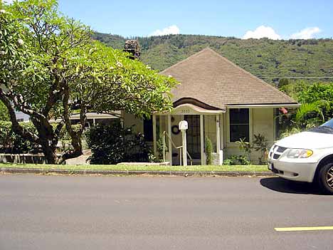
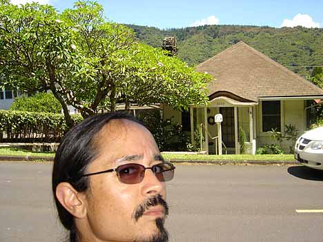
There it is. 3033 Oahu Avenue, Honolulu Hawaii, up in Manoa Valley. This is the house my young parents lived when I was born. The place has a new roof and has appreciated in value by nearly 4000% since ’69, but for the most part, it hasn’t changed much.
The camera is facing east:
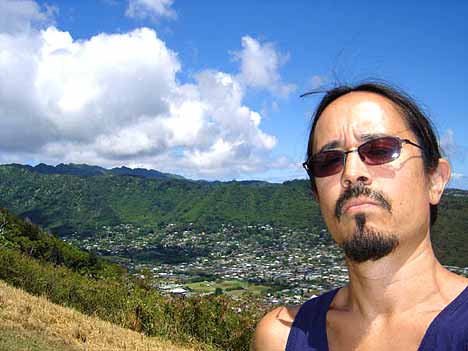
Below is a downward view of Manoa Valley from Tantalus, a mountain nearby. Manoa crawls north into the valley; the actual area of our house is further left than what’s visible here. Again, the camera is pointing approximately east:
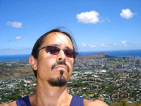
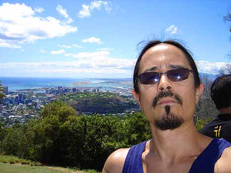
For perspective, below is a shot from the same Tantalus location, with the camera rotated about 45 degrees clockwise, pointing south-southeast. That’s the outer edge of Waikiki and Diamond Head in the background. Also, to the left of the photo over my right shoulder, notice the left-most isolated tall building. That’s the Kahala Hilton, the hotel my Auntie Joni danced for many years in Danny Kaleikini’s show, and also served as the location of Grampa’s 60th birthday bash in 1976:
OK, one more angle for perspective. We’re standing at the same location atop Tantalus, but the camera is now facing west. To the left of my right ear halfway into the background, you can see the memorial cemetery (partly covered in a cloud’s shadow), which is located at the top of Punchbowl (not far from Grampa and Gramma’s house). The last group of tall buildings behind Punchbowl is downtown Honolulu. Beyond that is the airport. You can see the isolated landing strip out on the water, which is the precise location every airborne Hawaii visitor first touched the Hawaiian soil prior to the outer-island-direct flights which have only been available in recent years:
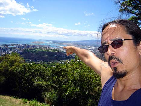


Sweet. Ain’t been to the main island but I am familiar with Maui and the Big Island. Don’t fall! It looks like a long way down. Is that a golf course over your right shoulder in the middle of the valley on the third shot?
Not sure if it’s a golf course, a ballfield, or even just a park. I’ll find out sometime.
Yo J,
Thanks for sharing that. I forgot you were born there! You ain’t no haole boy….you’re a poi fed, hula shakin’, hang loose local, …who can’t surf…!
Aloha,
-m
the last time i was there, we drove the eastern side of the island, up to turtle bay and north shore, and then cut back down through the middle on H2. i don’t know my oahu geography that well, but the vista from your pics reminds me a bit of the view on our way back into town. am i in the ballpark?
Close. You may be thinking of the recently completed H3. I’ll get the numbers for you, but that highway kept falling down during construction. Lots behind that story.
H3, an expressway of sorts, cuts over the island and hits the water @ Kaneohe. Beautiful drive through the valley, a couple of tunnels, and no off-ramps. From Kaneohe you can turn left and go north.
The H3 hits the Honolulu side closer to the airport. Our camera’s on the town’s premier lookout spot Tantalus, near Manoa. Da kine Inspiration Point, eh? So as you were coming into town from the north, you were up the other way in the westward photo. Different valley, but both equally gorgeous.